MINING


Mogalakwena mine


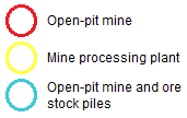
The Mogalakwena open-pit mine as seen from a 0,5m aerial photograph, is 30Km northwest of Mokopane in Limpopo Province. Visual interpretation of the image shows land features such as rock outcrops, settlements and mine infrastructure. The area within the red circle shows open-pit mining activity and in blue, open-pit mining activity as well as ore stockpiles. The area within the yellow circle shows the mine processing plant with conveyor belt, buildings,mineral stock pile, dam and other infrastructure.


Aerial photograph of Mogalekwena Mine courtesy of National Geo-spatial Information (CD NGI), South Africa.
Visit NGI website

Grootgeluk mine


Aerial photograph (0,5m) of Grootegeluk open-pit coal mine situated 25km from Lephalale in the Limpopo Province.


Aerial photograph of Grootgeluk Mine courtesy of National Geo-spatial Information (CD NGI), South Africa.
Visit NGI website

Back to top


© Copyright: South African National Space Agency 2015. All rights are reserved.